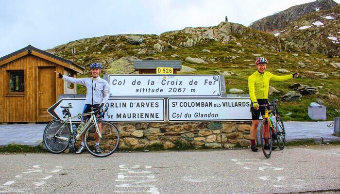
Col du Glandon (1924m)
In 1988 the Col du Glandon was opened and was first used in the 1947 Tour de France. It has been used a further 12 times since. It is mostly a question of stamina, for the majority of the ride doesn’t exceed a 6% gradient. You need to keep a little in reserve however, as the last kilometre of climbing is between 9 & 12% - great for a sense of accomplishment when you finally reach the top.
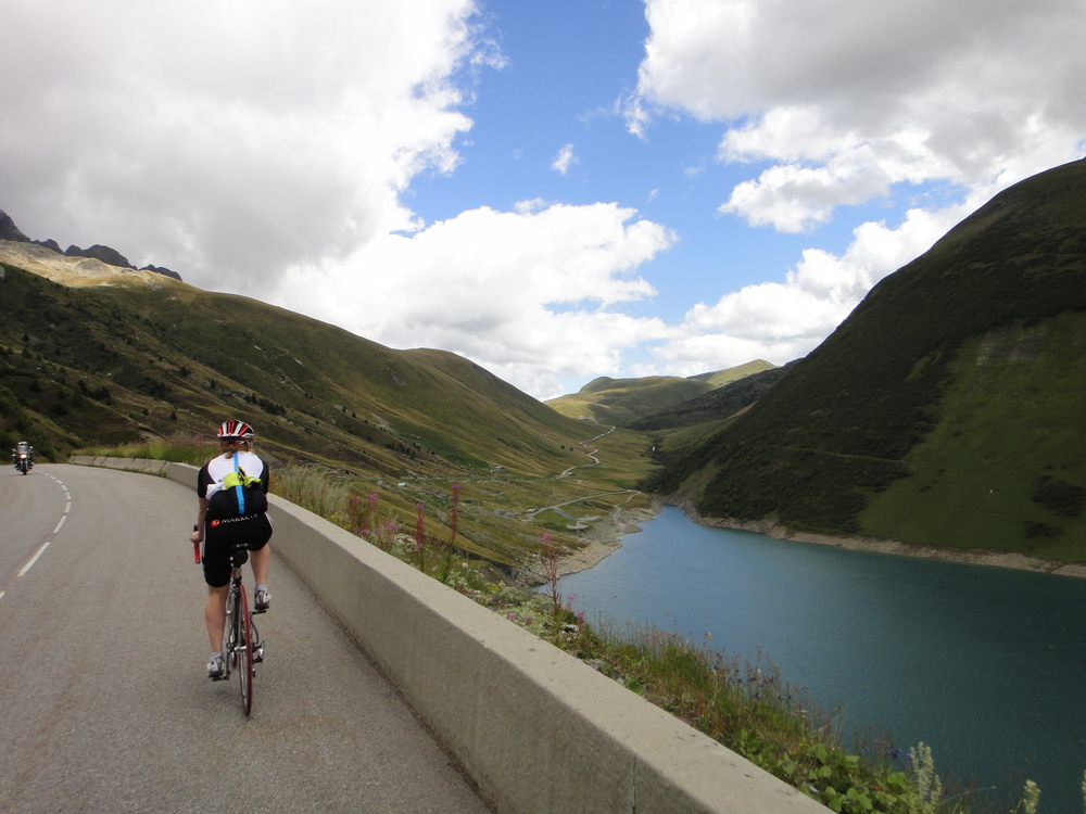
The Col du Glandon has a range of slopes and is considered to be a varied climb - not as long as the Col du Galibier nor as relentless as Alpe D’huez but at 31km, some think it’s harder than both! It can also be tackled from two directions; the climb from the north side, coming from the Maurienne valley is shorter but considerably steeper. The southern ascent is used in La Marmotte and is the first col to be tackled during the sportive. Both routes offer great scenery - a ‘must do’ ride during your stay in Vaujany.
From Vaujany, descend to the Lac de Verney and turn right at the junction. Then the road proceeds to a sharp steep switchback descent. After this the epic climb really kicks in (and the steepest part) up to the largest dam in Europe, La Grande Maison. Once past the lake the road flattens out and the valley widens. Here you can see the road climb up through the valley to the Col du Glandon.
Following a long downhill you approach the final 3km of climbing. After turning left at the signpost the top of the Col du Glandon is only a few hundred metres away - if you were to carry on along this road instead of turning off you would be on route to the Col de la Croix de Fer summit. From here you can see Mont Blanc, 90km in the distance, the highest peak in Europe.|
| Distance Travelled from Allemont | 25km |
| Maximum Altitude | 1924m |
| Minimum Altitude | 720m |
| Average Gradient | 4.8% |
| Maximum Gradient | 12% |

Extra Services
We will always try to work around your schedule. As a small specialist tour operator exclusively providing luxury holidays to Vaujany, we have the flexibility often missing from larger companies.
Be it to organise a quick second break, a weekend get-away for a large group or perhaps a corporate weekend, we can tailor make a break that meets all your requirements.

We've partnered with The Chalet Chef to make hosting memorable evening an absolute breeze. Their chefs will take care of everything for you from start to finish.
Cycling in the French Alps and Oisans area is a wonderful experience. Riding out of Vaujany every morning whether to train or compete, is like riding through the annals of cycling history.

There's nothing quite like a good pair of shoes, and bicycles work in a similar way; a good well-adjusted bike to suit your body type and riding ability will make you ride more comfortably, last longer and roll faster.
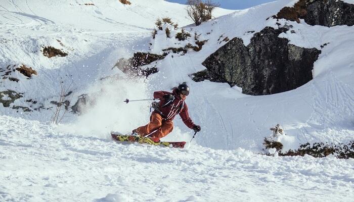
Skiing season over? Not a chance I hear you say! Think again - You can ski in the summer in the French Alps, no need to put away that precious ski gear.
Our Vaujany Accommodation


Our collection of Vaujany chalets are of the highest standard. Each chalet is designed to feel settled and welcoming, combining refined finishes with the warmth of a true mountain home. Our local team caters to your needs and will take care of you from the moment they meet you.